
All photos taken 2000 by Michael Brand
This particular stretch of roadway was renamed Pennsylvania 150 in 1968 when U.S. 220 was realigned and co-signed with the newly completed Interstate 80. In 1973, the roadway was abandoned and submerged when PA 150 was realigned upon the completion of Sayers Dam.
This original section U.S. 220 was exposed during the winter of 1999-2000 when the lake level was lowered to allow repairs to the dam.
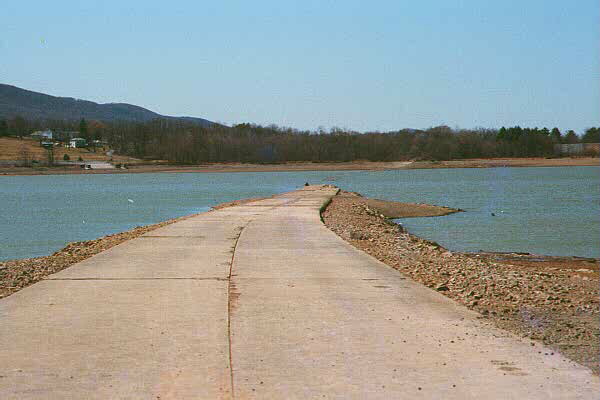
| This photo is looking south. The town of Howard is right behind the grove of trees. According to the Park Ranger, in the summer this section of road is under 30 feet of water.
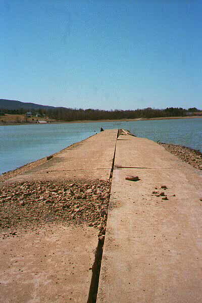
Also looking south. You can see here how the deep currents of the lake have undermined the old roadbed.
| 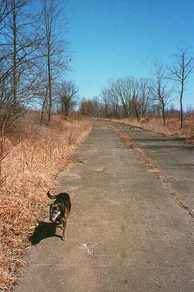
Most of old 220 that is not submerged has been converted to park roadway for fishing access. However, a few totally abandoned stretches are still around. This section is not far from a picnic area, but with 30 years of vegetation growth, you'd not notice the roadway unless stumbling upon it. The view here is looking north towards Beech Creek.
| |
According to Michael, the local name for Blanchard Lake is not as such. Since the dam backed up Bald Eagle Creek, everyone around there refers to the lake as Bald Eagle Lake.
The Lost Highway is copyright © 2005 by Jeffrey Carlyle. All photographers retain rights to their photographs. The Lost Highway was originally developed by Andy Field and Alex Nitzman for AARoads.