
Photos taken by Andy Field, Casey Cooper, and Joel Windmiller on June 16, 2001.
On June 16, 2001, Casey Cooper, Joel Windmiller, and Andy took a bike trip along Old U.S. 101 from San Clemente south to Las Pulgas Road. The distance on the trip was about 26 miles round-trip, with several stops and breaks in between. All photos in this series of pages were taken with a digital camera.
Abandoned U.S. 101 at San Mateo Creek Bridge
|
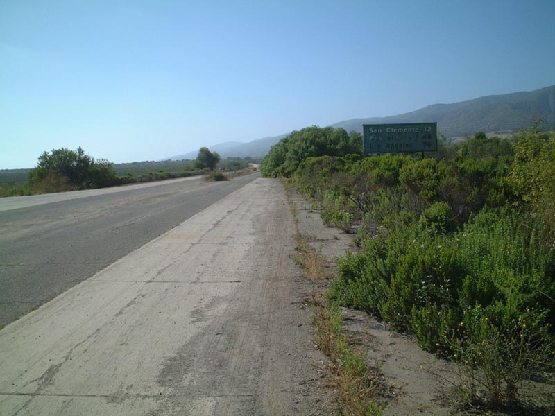
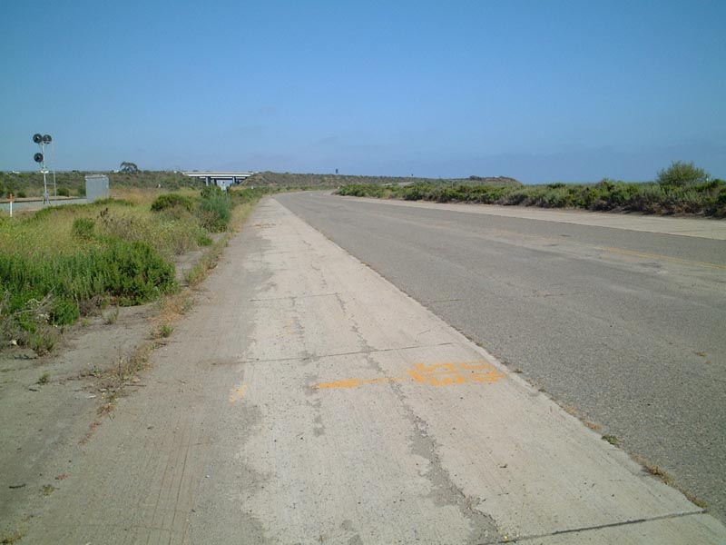
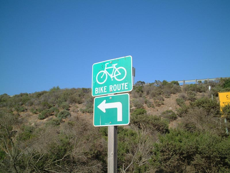
From the parking area on Cristianitos Road, we left San Clemente heading south onto the old highway, designated as a bicycle route.
| 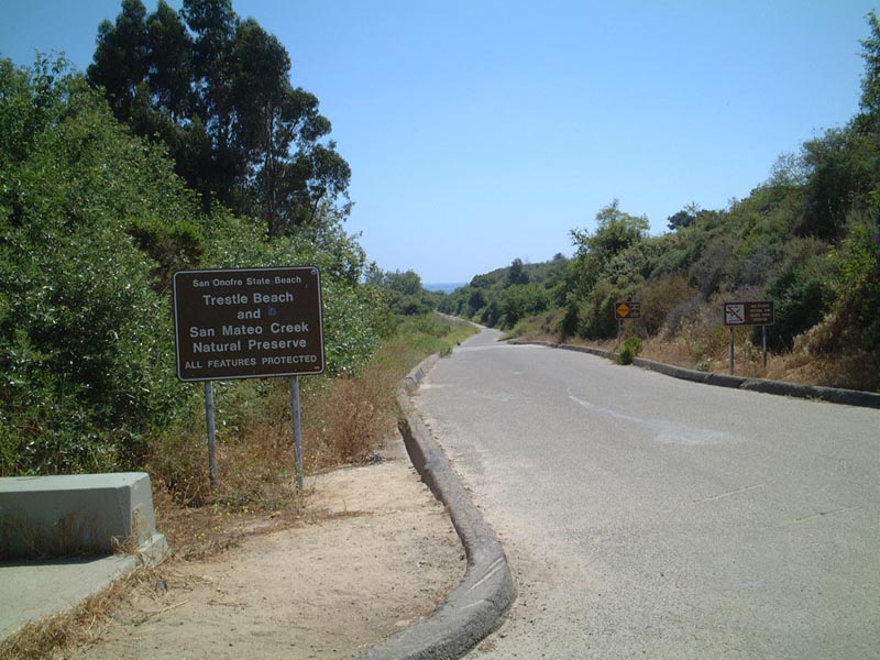
This sign points to the beach access in the immediate vicinity of San Mateo Creek within San Onofre State Beach.
| 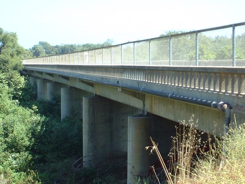
The abandoned U.S. 101 crossing over San Mateo Creek is still intact, alongside the modern Interstate 5 freeway. San Mateo Creek runs east-west between Cristianitos Road and Basilone Road in extreme northern San Diego County within San Onofre State Beach. This section of old U.S. 101 is part of the bike route.
| 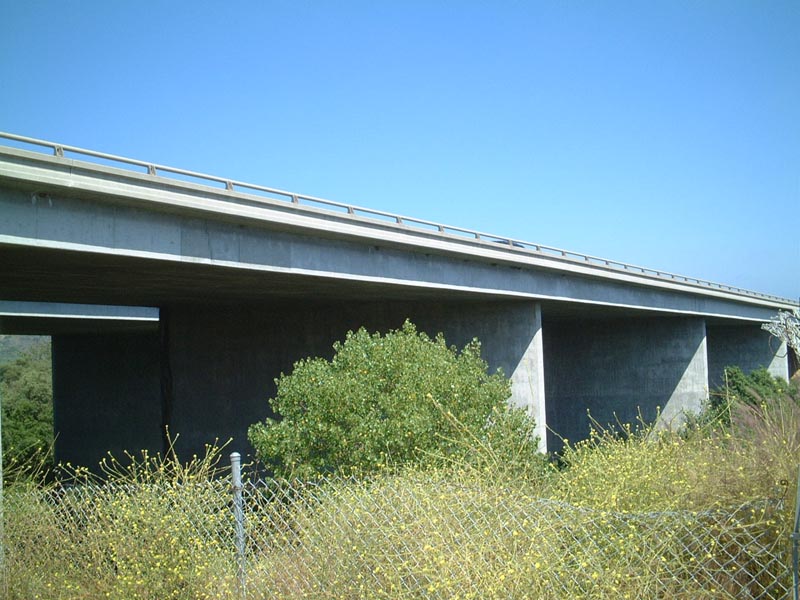
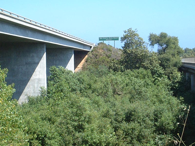
This is the modern Interstate 5 freeway bridge over San Mateo Creek just east of the abandoned U.S. 101 bridge.
| 
Abandoned U.S. 101 bridge over San Mateo Creek, looking south (#1). The bridge is now used by bicyclists and pedestrians.
| 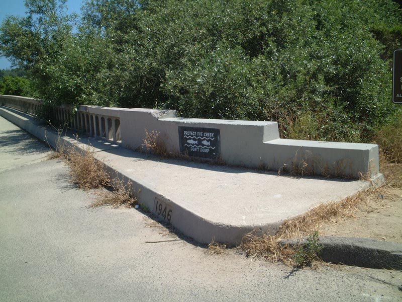
Abandoned U.S. 101 bridge over San Mateo Creek, looking south (#2). Note the date stamp (1946) on the bridge.
| 
Abandoned U.S. 101 bridge over San Mateo Creek, looking south (#3).
| 
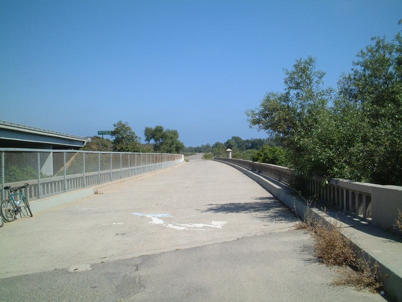
Comparison of Interstate 5 and old U.S. 101 bridges over San Mateo Creek, looking south.
| 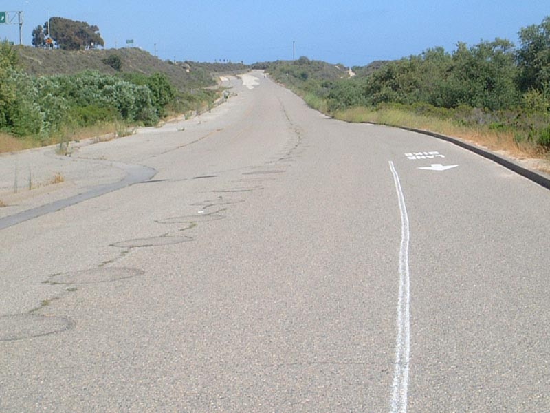
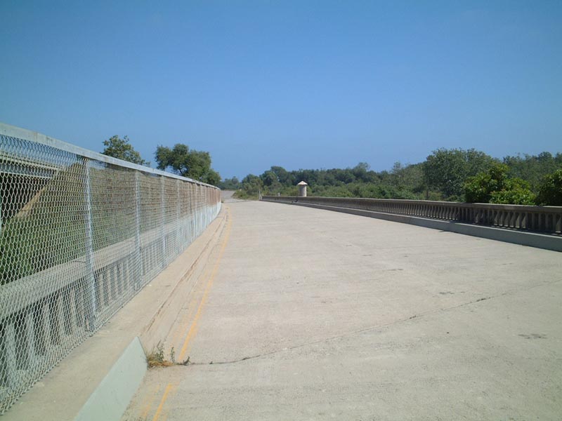
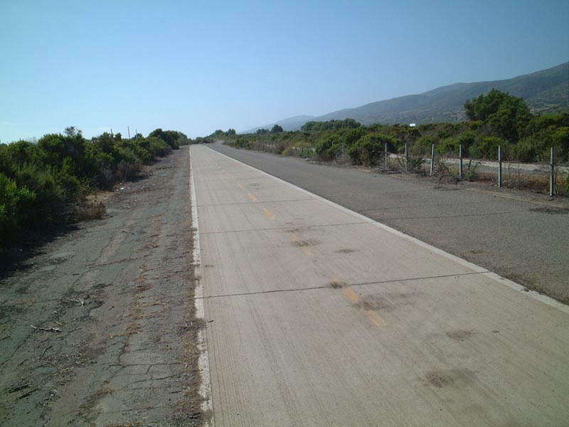
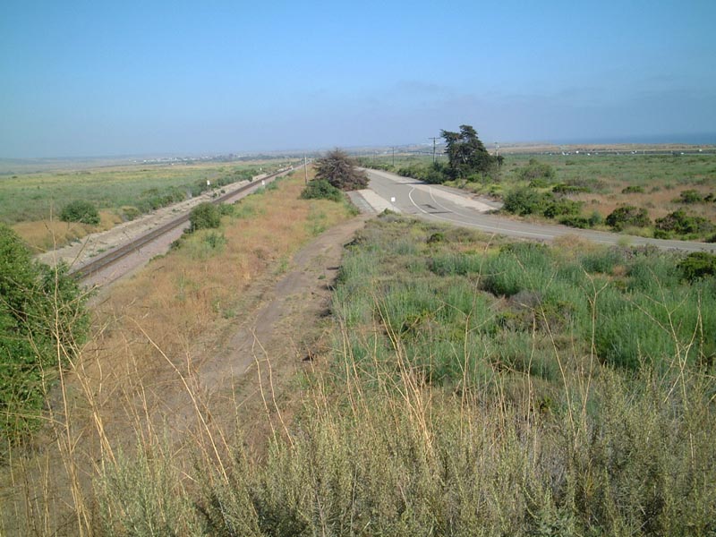
Southbound Abandoned U.S. 101 heading away from San Mateo Creek bridge, approaching the Basilone Road Exit.
| 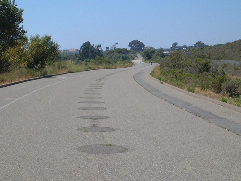
Looking north, back toward the San Mateo Creek Bridge and the Interstate 5 freeway to the east (right).
| Abandoned U.S. 101: Basilone Road Approach
| 
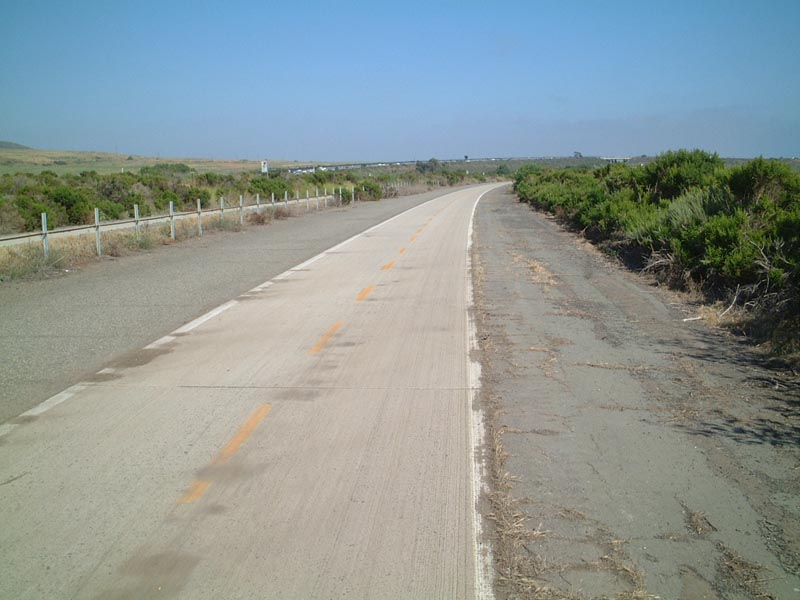
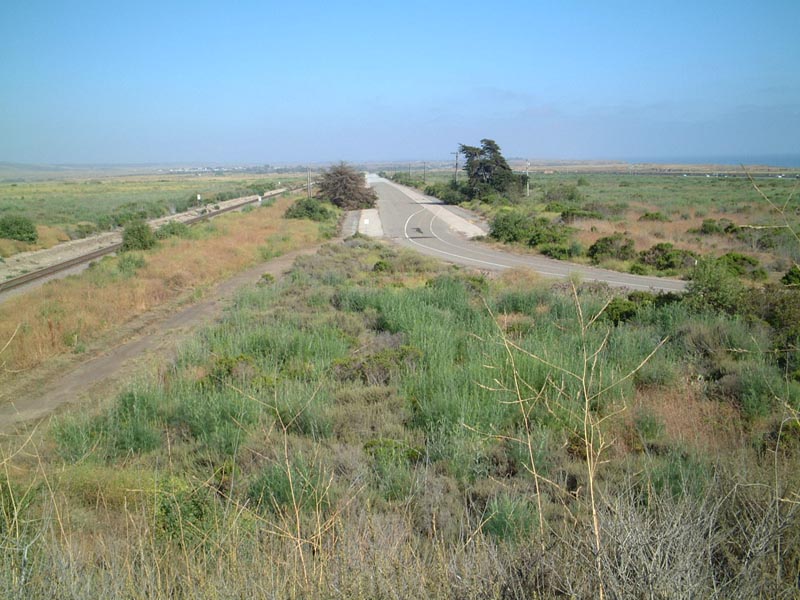
Abandoned U.S. 101 between Cristianitos Road and Basilone Road. This section of U.S. 101 is very close to the freeway, and it acts as a connector from some remote parking areas to the state beach for pedestrians and bicyclists.
| 
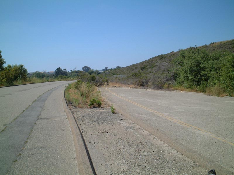
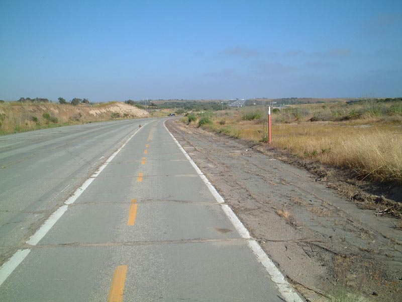
Looking south, you can see the exit signage for Basilone Road and how the concrete is buried by the construction of the interchange.
| 
The concrete section of abandoned U.S. 101 is supersceded by the construction of the Basilone Road interchange. This is looking south.
| 
This is looking north from the same spot as the previous photo.
| 
Another view of the divided highway, looking north from near Basilone Road.
| Abandoned U.S. 101 Approaching San Onofre State Beach
| 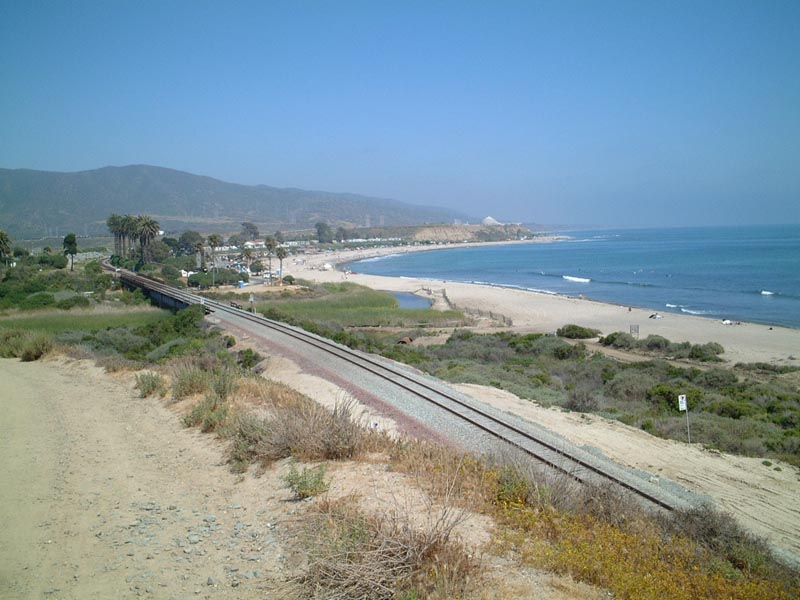
Coastal view of the San Onofre State Beach, including the nuclear power plant. Abandoned U.S. 101 follows this coastline closely.
| 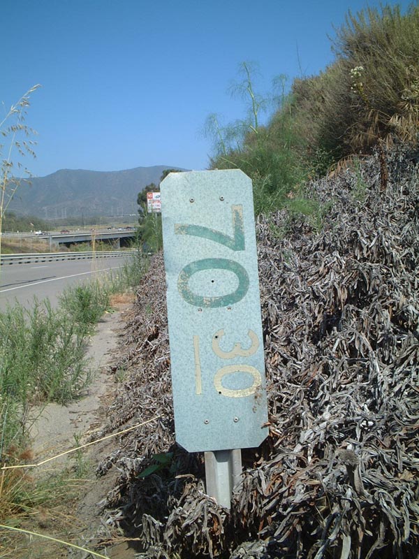
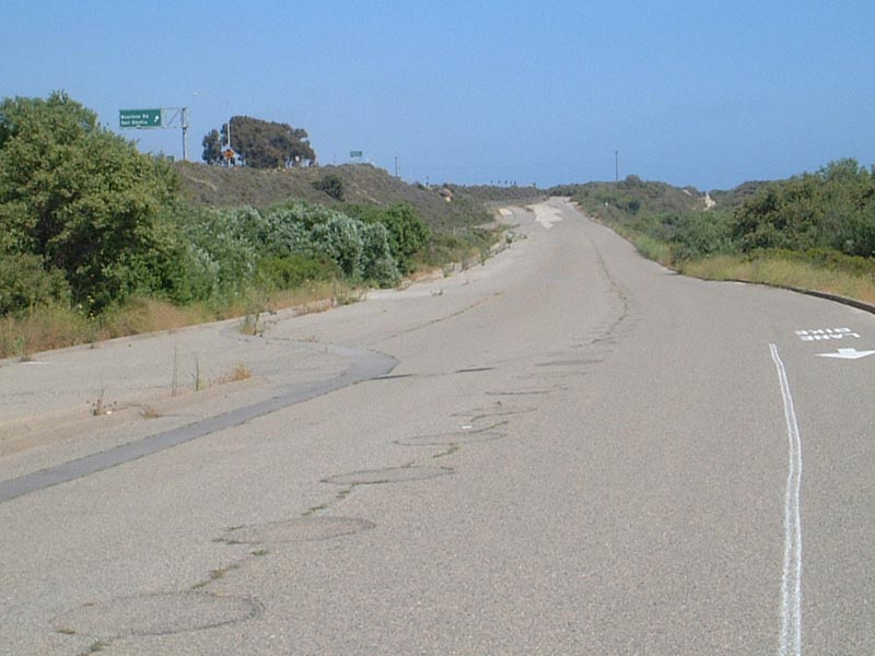
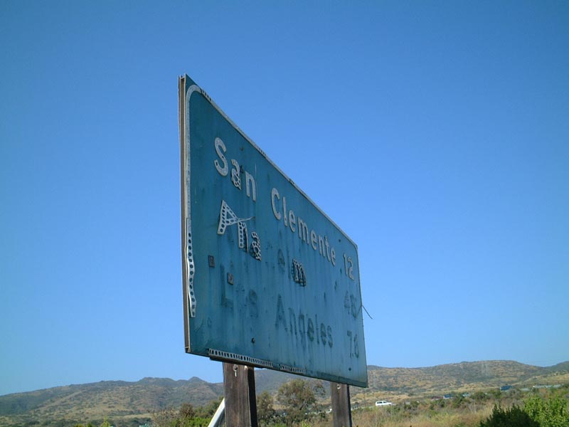
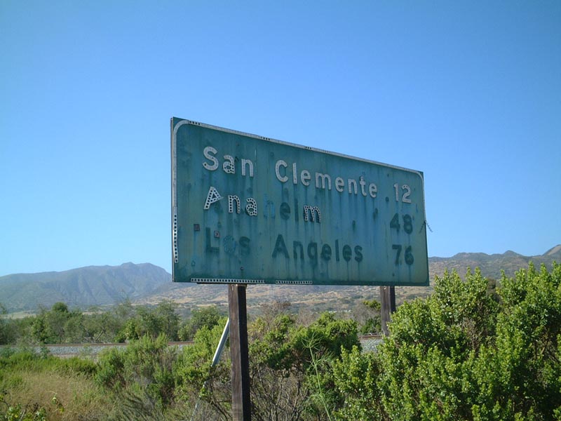
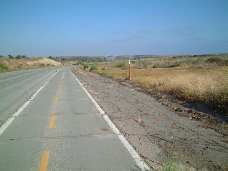
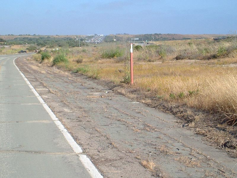
This gem of a sign harkens back to the failed first attempt to sign Interstate mileage in California. This sign used to be white on green, and the numbers should reflect the distance from this point to the southern terminus of Interstate 5. Only a handful of these signs from the experiment to sign Interstate mileposts in California remain, and they are rarely as accessible as this one (since most are located on mainlines of freeways). This sign is located on the frontage road that follows old U.S. 101 and also provides access to the San Onofre State Beach and to the San Onofre Nuclear Power Plant.
| 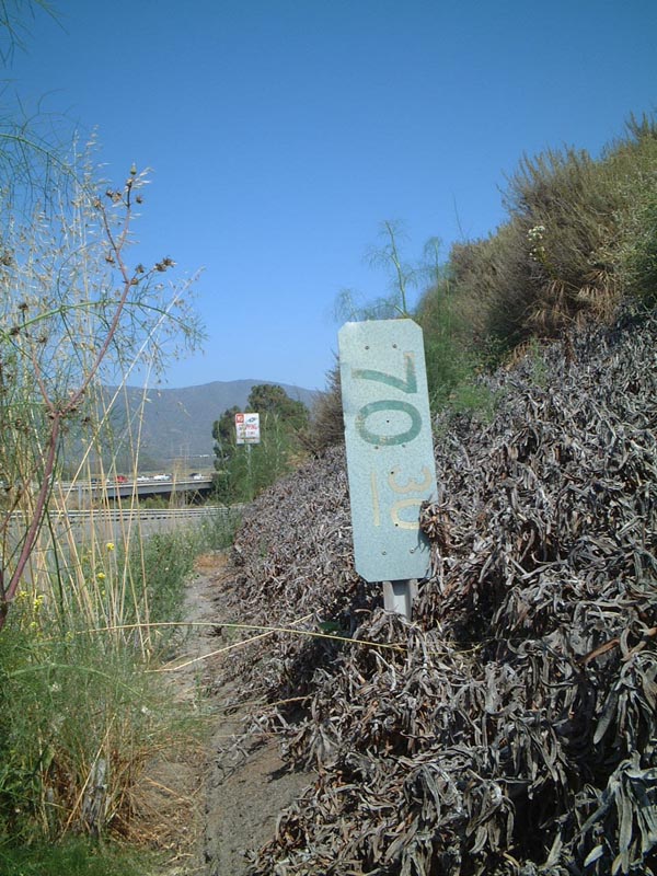
Milepost 70.30 context. This milepost is for Interstate 5, 70.30 miles north of the California-Mexico border.
| 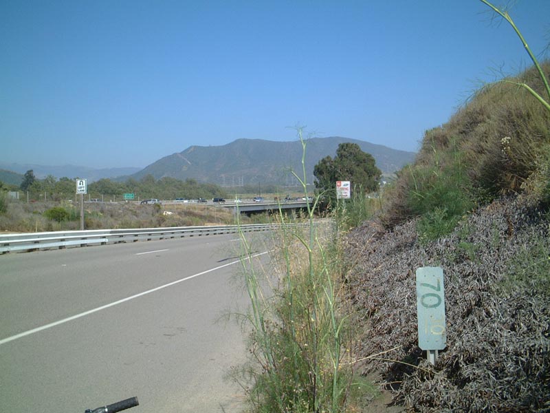
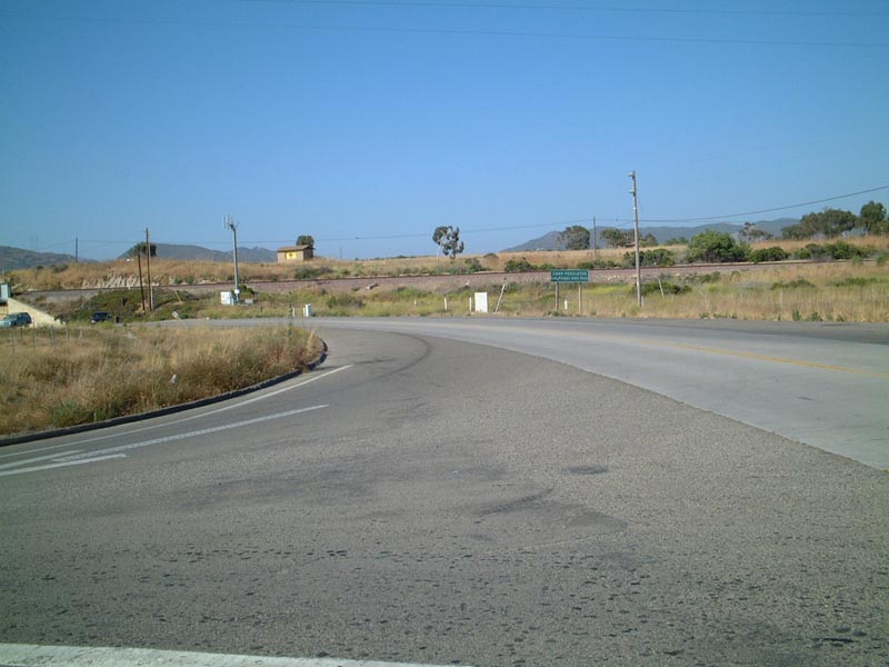
An even broader context of the frontage road that has this milepost.
| Abandoned U.S. 101: Former Interstate 5 in Camp Pendleton
| This abandoned stretch of U.S. 101 also served as Interstate 5 while that freeway was being on a new alignment through Camp Pendleton. It is hard to imagine the traffic on this narrow road, especially given the modern look and feel of Interstate 5.
| 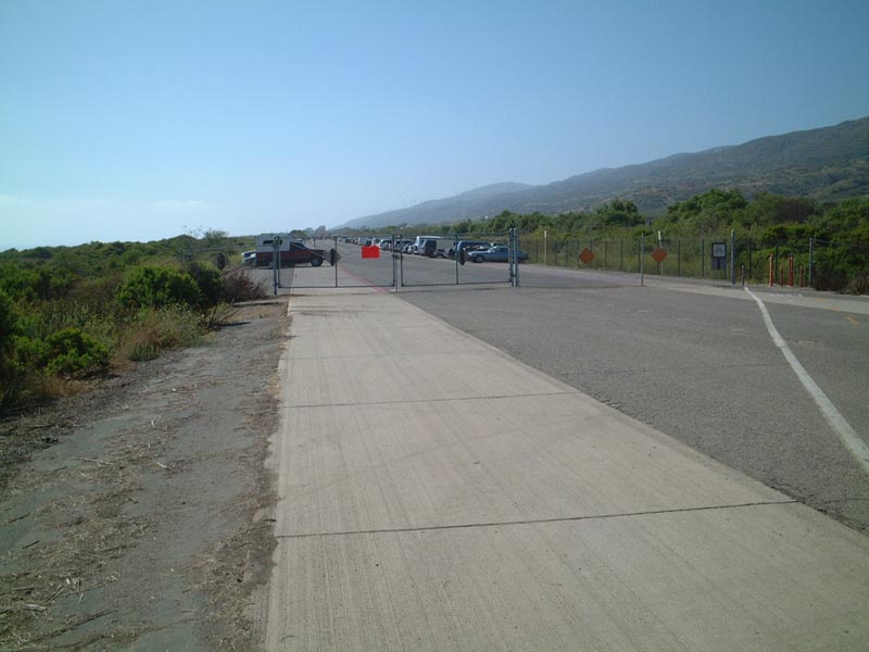
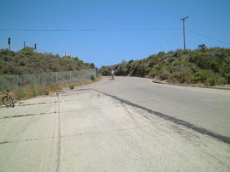
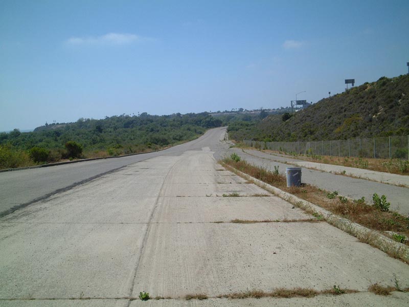
Abandoned U.S. 101 at the border of San Onofre State Beach and Camp Pendleton (#1) This photo looks north, into the state beach. The old highway has been transformed into a parking lot/access drive through the state beach, with old concrete present throughout. This gate (located just south of Beach Access #6), which separates the state beach with the military reserve, is not accessible by motorized vehicles unless authorized. The character of the old road is much more prevalent on the military base, as shown by the following photos.
| 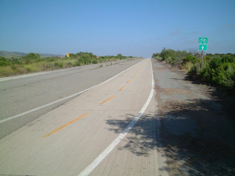
Abandoned U.S. 101 at the border of San Onofre State Beach and Camp Pendleton (#2). This is just south of the gate, looking southbound. The route is designated as a public bike path, and it provides bicycles the only path through the Interstate 5 corridor between Orange and San Diego Counties.
| 
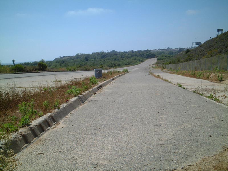
Abandoned U.S. 101 at the border of San Onofre State Beach and Camp Pendleton (#3). This is looking north, but this picture was taken about a mile or so south of the gate, so you can't see the gate in this picture due to the curve in the road.
| 
Abandoned U.S. 101 at the border of San Onofre State Beach and Camp Pendleton (#4). Note the fence in the old median to the left. This picture faces south. The next photo shows a close-up of the 1946 concrete stamp.
| 
Abandoned U.S. 101 at the border of San Onofre State Beach and Camp Pendleton (#5). Close-up of the 1946 concrete stamp.
| 
Abandoned U.S. 101 at the border of San Onofre State Beach and Camp Pendleton (#6).
| 
Abandoned U.S. 101 at the border of San Onofre State Beach and Camp Pendleton (#7), facing south. This picture shows both directions of the old divided highway.
| 
Abandoned U.S. 101 at the border of San Onofre State Beach and Camp Pendleton (#8), facing north.
| 
Abandoned U.S. 101 at the border of San Onofre State Beach and Camp Pendleton (#9), facing south.
| 
Abandoned U.S. 101 at the border of San Onofre State Beach and Camp Pendleton (#10), facing south.
| 
Abandoned U.S. 101 at the border of San Onofre State Beach and Camp Pendleton (#11), facing north.
| Abandoned U.S. 101 Mileage Sign in Camp Pendleton
| U.S. 101 at one time served as the Interstate 5 freeway through Camp Pendleton; this abandoned stretch even has a mileage sign that still remains decades later.
| 
Abandoned mileage signage along Northbound U.S. 101 within Camp Pendleton. It is unclear as to why this sign still remains, while most others were removed. It is in very poor condition, and Casey noted that it has gotten considerably worse due to vandalism and weather just in the few years since his last trip through here.
| 
Context of abandoned mileage sign.
| 
Abandoned U.S. 101 looking southbound from the abandoned sign.
| 
Close-up of abandoned sign (#1).
| 
Close-up of abandoned sign (#2).
| Abandoned U.S. 101: Interstate 5 Underpass in Camp Pendleton
| 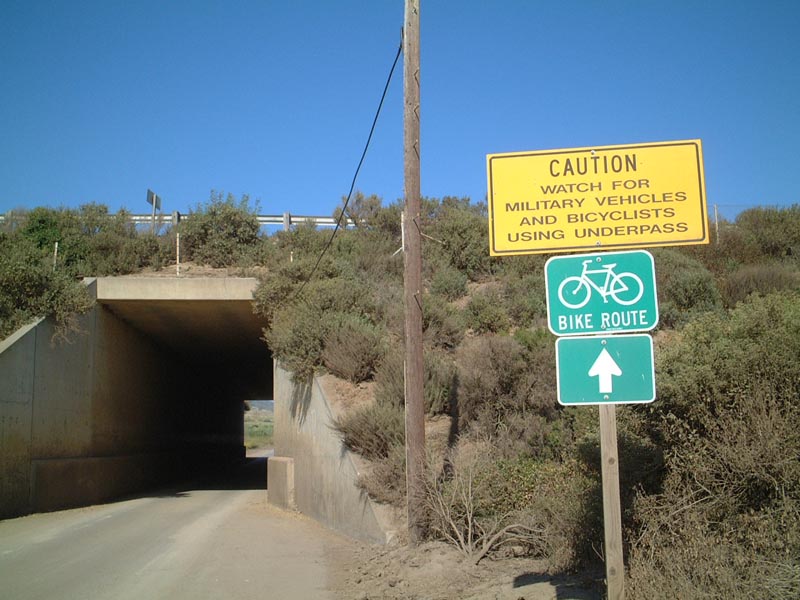
Undercrossing of U.S. 101 under Interstate 5. This undercrossing is just north of the view area for southbound Interstate 5 traffic. A spur from the bike route here leads to that view area.
| 
Another view of the U.S. 101 undercrossing at Interstate 5 shows the bike route signage.
| 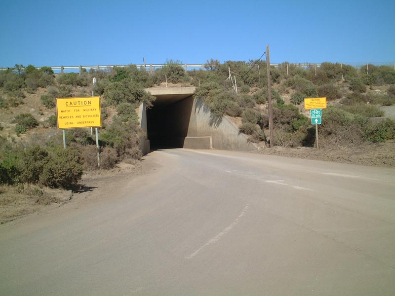
Yet another view of the U.S. 101 undercrossing at Interstate 5, which shows that military vehicles and bicycles must share the roadway here.
| Abandoned U.S. 101: Camp Pendleton Overpass
| 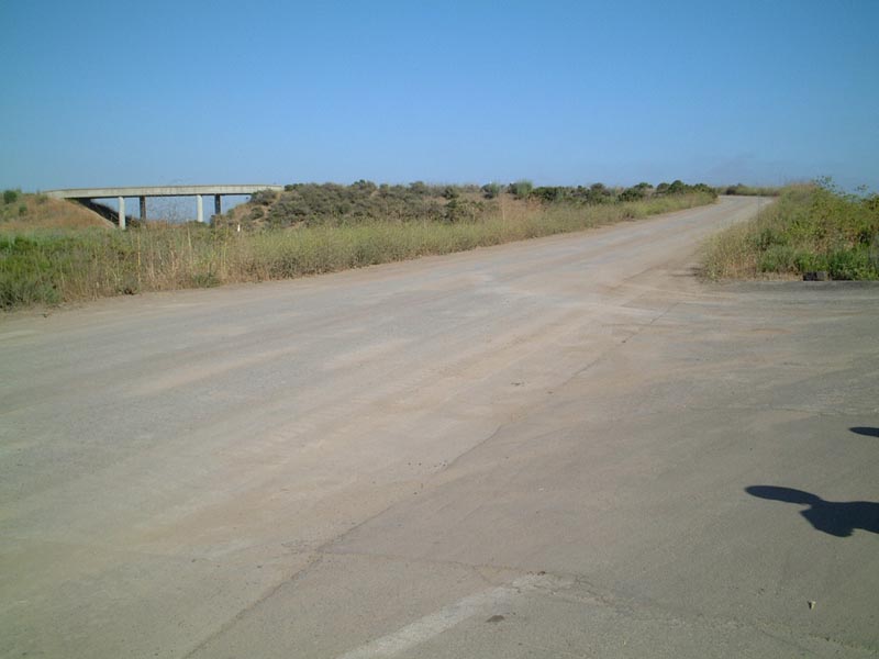
This Camp Pendleton Overpass, which leads over railroad tracks to other parts of the military base, is not open to through traffic. The railroad provides Amtrak service through the military base. We took a few pictures from the bridge, but we did not proceed any further inland from there.
| 
Another view of the Camp Pendleton Overpass.
| 
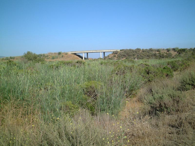
Abandoned U.S. 101, as seen looking south from the overpass in Camp Pendleton (#1).
| 
Abandoned U.S. 101, as seen looking south from the overpass in Camp Pendleton (#2).
| Abandoned U.S. 101 Through Camp Pendleton Approaching Las Pulgas Road
| 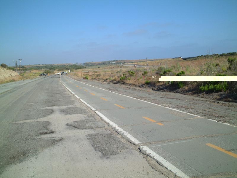
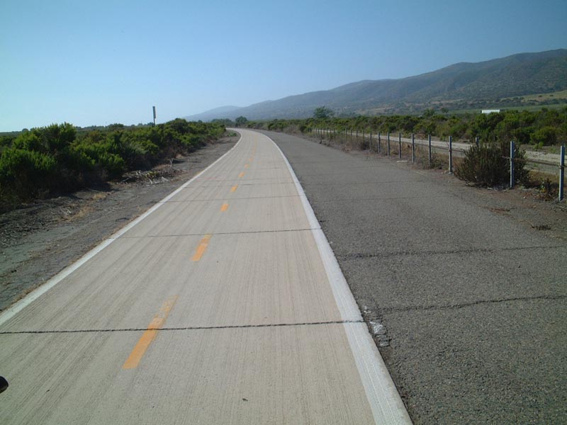
Southbound Abandoned U.S. 101 approaching Las Pulgas Road (#1).
| 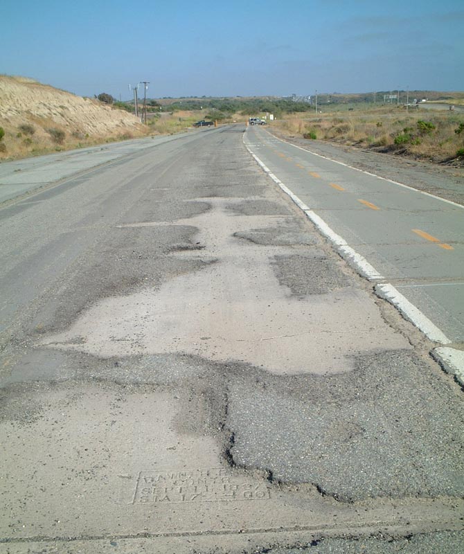
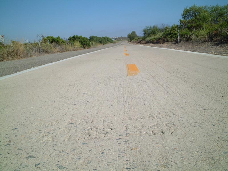
Southbound Abandoned U.S. 101 approaching Las Pulgas Road (#2). Note the date stamp for the original U.S. 101 concrete here.
| 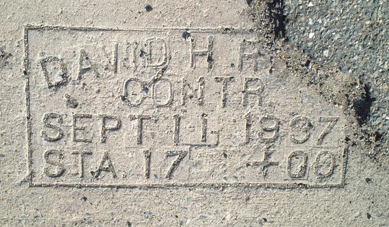
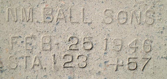
Southbound Abandoned U.S. 101 approaching Las Pulgas Road (#3). Close-Up of the concrete date stamp.
| 
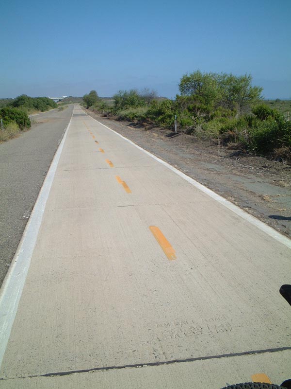
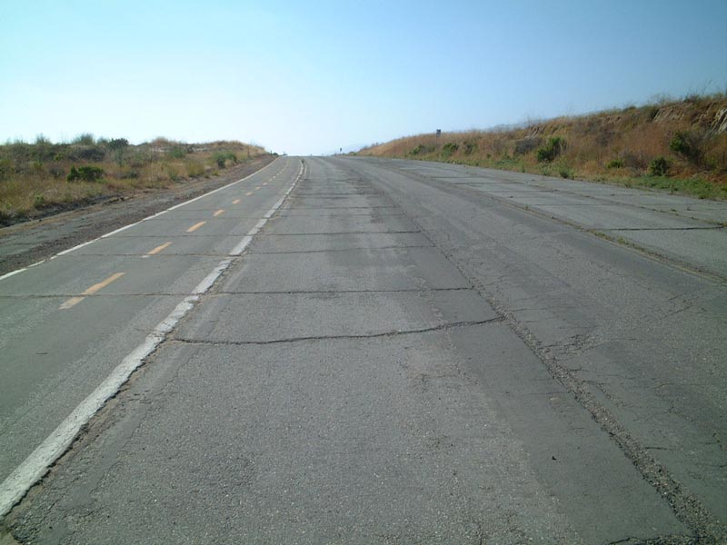
Southbound Abandoned U.S. 101 approaching Las Pulgas Road (#4). The striping of the old road is set for bicyclist use.
| 
Southbound Abandoned U.S. 101 approaching Las Pulgas Road (#5). This picture shows the Interstate 5 freeway from the old road.
| 
The long section of abandoned U.S. 101 that we've been following ends at Las Pulgas Road. Bikes may turn left to enter the base and ride along a base road to continue onward toward San Diego County. A right turn leads to the freeway.
| 
Northbound Abandoned U.S. 101 leaving Las Pulgas Road, which marks the beginning of the 13-14 mile ride back to San Clemente.
| 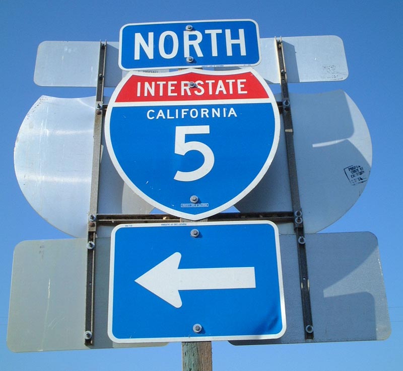
Interstate 5 shield at Las Pulgas Road.
| 
Interstate 5 shield at Las Pulgas Road (Context).
| 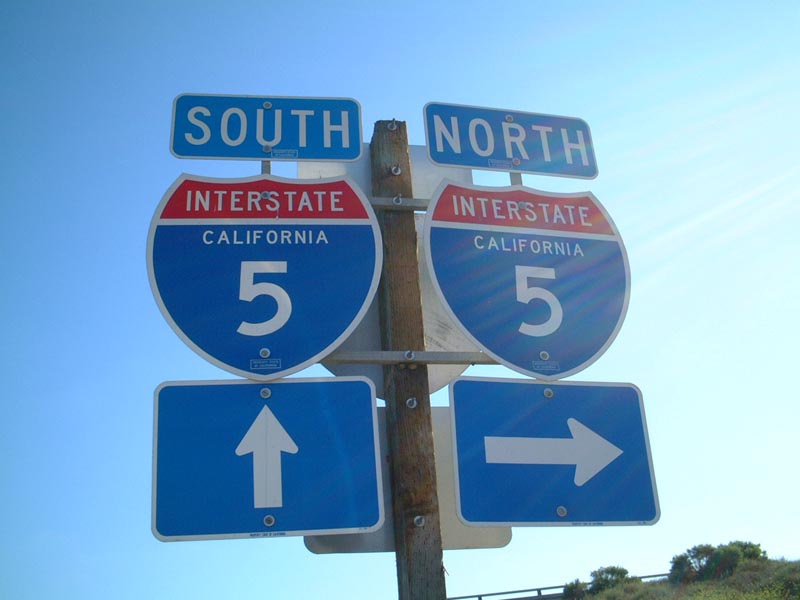
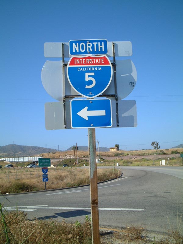
More Interstate 5 shields at Las Pulgas Road.
| 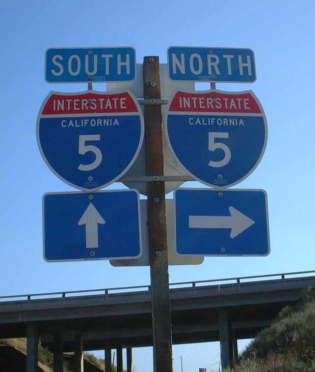
Interstate 5 shields at Las Pulgas Road (#2).
| | |||||||||||||||||||||||||||||||||||||||||||||||||||||||||||||||
|---|---|---|---|---|---|---|---|---|---|---|---|---|---|---|---|---|---|---|---|---|---|---|---|---|---|---|---|---|---|---|---|---|---|---|---|---|---|---|---|---|---|---|---|---|---|---|---|---|---|---|---|---|---|---|---|---|---|---|---|---|---|---|---|---|---|---|---|---|---|---|---|---|---|---|---|---|---|---|---|---|---|---|---|---|---|---|---|---|---|---|---|---|---|---|---|---|---|---|---|---|---|---|---|---|---|---|---|---|---|---|---|---|---|---|---|---|---|---|---|---|---|---|---|---|---|
The Lost Highway is copyright © 2005 by Jeffrey Carlyle. All photographers retain rights to their photographs. The Lost Highway was originally developed by Andy Field and Alex Nitzman for AARoads.