
Photos taken July 27, 2002 and write-up by
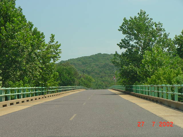
| According to author C.H. Curtis in his book The Missouri Route 66 Tour Book, this bridge over the Meramec River was built in 1931. The bridge and road are now the entrance to Route 66 State Park. The site is famous for another reason as well. It was in this area that the town of Times Beach, Missouri was established. Times Beach was abandoned in the 1980s after the Environmental Protection Agency (EPA) determined that oil sprayed on the roads during the 1970s to reduce dust contamination contained dioxin. While the town was closed, this bridge was also closed for a period of time.

As you travel west on Interstate 44, if you look to your right, you can see the old U.S. 66 bridge as it crosses the Meramec river, running parallel to the interstate.
| 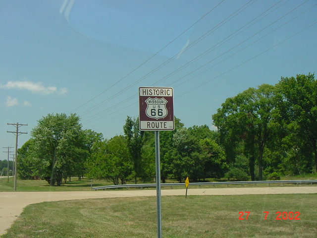
These markers are featured along the remaining alignments of U.S. 66 along its route to California. This marker sits on the old road after you cross the Meramec river bridge heading west into the State Park.
| 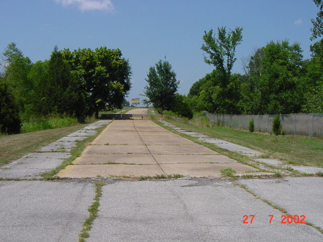
This section of road would have aligned with what is now Interstate 44. The concrete in the middle of the asphalt appears to be an old exit ramp. In the background, you can see the concrete barriers blocking access to the interstate. Interesting note, this was the site of the Sylvan Beach Park during the 1930s, 1940s and early 1950s. The park was razed in 1954 to make way for the dual bridge construction of New U.S. 66, now Interstate 44.
| 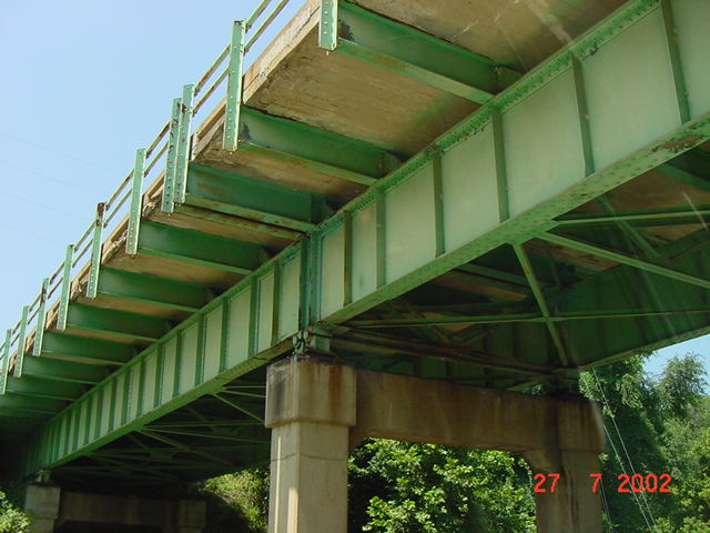
This photo was taken from an access road that runs (to a dead end) beneath the bridge. Notice the thickness of the concrete.
| 
To get to this alignment, you have to get back on the interstate. Interstate 44 runs directly over U.S. 66 for several miles. You exit at Six Flags over Mid-America amusement park, cross under the bridge and make a right turn at the intersection. There are some interesting rock formation along this section of the old road.
| 
The bluffs to the right of the road (North side) in this photo are one example of several you see along this section of road. Also, some of the utility poles appear to be as old as the road itself. Heading west, this will take you into Pacific, Missouri. You can follow this road as it runs south of Interstate 44 to the junction with Missouri 100 at Gray Summit, Missouri.
| |
The Lost Highway is copyright © 2005 by Jeffrey Carlyle. All photographers retain rights to their photographs. The Lost Highway was originally developed by Andy Field and Alex Nitzman for AARoads.