
Photos by Adam Froehlig (2000) and Rusty Pugh (2003)
This series is for an old, mostly abandoned section of US 45 south of Quitman in Clarke County, including the old half-gone bridge over the Chickasawhay River. AFAIK, this section was bypassed sometime in the 1950s, and except for a short stretch at the southernmost end, is fully abandoned. These pictures were all taken in late 2000 (November, IIRC). - Adam Froehlig

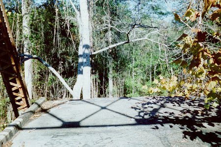
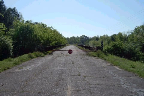
| This picture is from the section that is "still in use". In
effect, it is a Clark County road with extremely old pavement. This is at the north end of this "useable"
section, looking south. The southernmost end, representing the southern end of the bypass section, is at
the US 45/MS 18 split. Photo taken by Adam Froehlig.

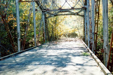
Pavement on the fully abandoned section. Notice how cracked
and weed-ridden it is. Photo taken by Adam Froehlig.
| 
Looking at the bridge. Photo taken by Adam Froehlig.
| 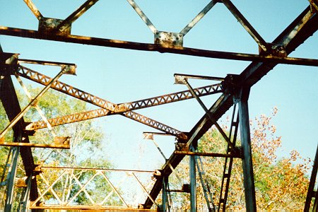
Notice how some of the overhead truss is broke and missing.
Photo taken by Adam Froehlig.
| 
The end of the bridge, halfway across. The best guess I
have is that it was washed away in a flood (the Chickasawhay is known to flood from time to time). North of
the river, the old roadbed is gone entirely...no trace of it. Photo taken by Adam Froehlig.
| 
Looking back south at the south end of the old bridge.
Photo taken by Adam Froehlig.
| |
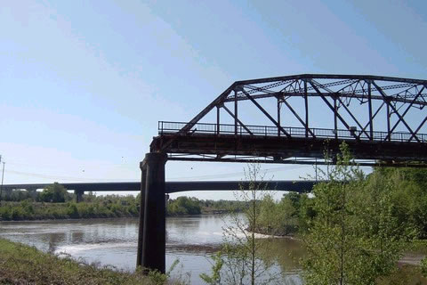
Another in the proverbial series of "the bridge to nowhere," one can find an abandoned bridge that constitutes the original U.S. 45 near the town of Aberdeen, Mississippi. The two-lane truss bridge took U.S. 45 across the Tombigbee River east of the town in rural Monroe County. Adding to the interest of this artifact is the fact that when the Tenn-Tom waterway was constructed through this area, many bends and curves of the old river were straightened and bypassed. This river relocation saw the need for a new four-lane crossing of U.S. 45 a few hundred yards downstream from the original span. However, rather than demolishing the old bridge, the original structure saw partial removal with the western segment left to dangle in mid-air. The west end still leads into Aberdeen on the original and now closed alignment of U.S. 45. For years the structure saw use as a loading facility for barges, but has since been completely decomissioned. Built in the late 1920s, the span remained in operation through to the middle 1980s.
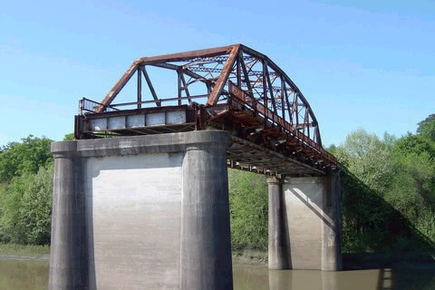
| The western half of the bridge remains in place over the
Tombigbee River. Photo taken by Rusty Pugh.
Southward view from the western banks of the Tombigbee River
at the original U.S. 45 crossing and the current bridge in the distance. Photo taken by Rusty Pugh.
| 
A look at the original U.S. 45 alignment as it leaves the town of Aberdeen
on the approach to the Tombigbee River bridge from the north. Photo taken by Rusty Pugh.
| |
Page Updated January 22, 2004.
The Lost Highway is copyright © 2005 by Jeffrey Carlyle. All photographers retain rights to their photographs. The Lost Highway was originally developed by Andy Field and Alex Nitzman for AARoads.